

Current filter:
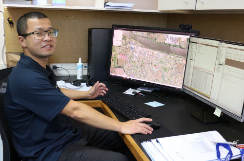
Gorden Jiang (pictured) is literally putting Wairoa on the map.
The Geographical Information System (GIS) Officer is the new man behind Wairoa District Council’s mapping services.
A Geographical Information System includes a series of software tools used to create, manage, analyse, and map all types of data.
All Council’s have a GIS portal where public information is mapped out. Gorden’s role is to implement and deliver GIS services to Council and provide internal IT maintenance and desktop support.
Council information is integrated into the Geographical Information System and includes a range of data from property details and consents to the locations of freedom camping area, public toilets and burial plots at local cemeteries.
Integrating building, property and land information is all part of Gorden’s new role.
Born in China, Gorden came to New Zealand in 2014 to study. Through Massey University he gained his Masters in Environmental Management and PhD in environmental science based around precision agriculture and geospatial data.
Gorden then had a stint as a city ambassador to for the Palmerston North City Council where he welcomed people to Palmerston North, helped organise events and liaised with local businesses. His next position was with the Hawke’s Bay Regional Council as an environmental data analyst.
The Wairoa GIS position is exactly the type of role Gorden had been looking for and so far, he has not been disappointed. “This job is challenging in many aspects, but I am enjoying it. As technology has grown so has the demand for updating systems and optimising performance.”
By the end of June, the system will become cloud based so will no longer require hosting data on site which will create efficiencies and cost savings.
Gorden says the team has been working through some technical issues and he thanks people for their patience while these have been sorted these out. “The system needs to be managed very carefully to provide the most up-to-date information to the public.
“I am enjoying the work and the team culture at the Council. Wairoa has a nice slow pace with good people, and I enjoy living in small towns.”
To check out Wairoa’s Geographical Information System head to the Wairoa District Council website www.wairoadc.govt.nz/services/maps-and-gis/
3 March 2022
customerservices@wairoadc.govt.nz
+64 6 838 7309
+64 6 838 8874
Coronation Square, Queen Street, Wairoa
PO Box 54, Wairoa 4160, Hawke's Bay
Disclaimers | Copyright | Privacy
![]()
Disclaimers and Copyright
While every endeavour has been taken by the Wairoa District Council to ensure that the information on this website is
accurate and up to date, Wairoa District Council shall not be liable for any loss suffered through the use, directly or indirectly, of information on this website. Information contained has been assembled in good faith.
Some of the information available in this site is from the New Zealand Public domain and supplied by relevant
government agencies. Wairoa District Council cannot accept any liability for its accuracy or content.
Portions of the information and material on this site, including data, pages, documents, online
graphics and images are protected by copyright, unless specifically notified to the contrary. Externally sourced
information or material is copyright to the respective provider.
© Wairoa District Council - www.wairoadc.govt.nz / +64 6 838 7309 / customerservices@wairoadc.govt.nz