

Current filter:
Wairoa’s heavy rain warning has been upgraded to red level.
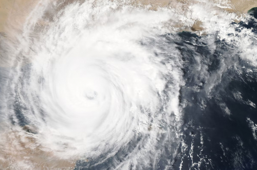
The Metservice has upgraded the Ex-Tropical Cyclone Fili severe weather warning for Wairoa and Gisborne with 250 - 350 mm of rain forecast for the Wairoa district and gales up to 120kmh forecast in exposed places.
Dangerous River conditions and flooding are expected. Slips and floodwaters will make driving conditions dangerous and will make some roads impassable isolating some rural communities.
Strong wind gusts could damage trees, powerlines and unsecured structures. Driving may be hazardous, especially for high-sided vehicles and motorcycles.
Wairoa Mayor Craig Little said Wairoa is working closely with Hawke’s Bay Civil Defence Emergency Management, the Hawke’s Bay Regional Council and Tairawhiti and other Hawke’s Bay Councils around the event.
“Locally, we will be working on the ground with the community to get through this rainfall. The situation is being monitored and agencies are working in response mode.
“Ex-Tropical Cyclone Fili is expected to hit the region later tonight. Now is the time to make any preparations needed eg moving at risk stock to higher ground and securing structures where needed and getting in any necessary supplies.
“Because our community is still recovering from the rainfall in March, this burst of further significant rain will cause additional slips and worsen damage to already saturated land. People need to be aware they may lose their power, and trees and landslides already impacted from the end of March weather event could now be further compromised.
“For those people who live close to waterways or steep slopes, then you should be prepared to evacuate. This weather event is likely to particularly going to impact coastal and rural areas, so we're encouraging farmers to move stock and equipment to high ground.
“Everyone should watch out for updates as the weather progresses and be prepared to move or seek help if they feel at risk.”
Stay up-to-date with forecasts at MetService, and check for updates on the HBCDEM Facebook page and website.
12 April 2022
customerservices@wairoadc.govt.nz
+64 6 838 7309
+64 6 838 8874
Coronation Square, Queen Street, Wairoa
PO Box 54, Wairoa 4160, Hawke's Bay
Disclaimers | Copyright | Privacy
![]()
Disclaimers and Copyright
While every endeavour has been taken by the Wairoa District Council to ensure that the information on this website is
accurate and up to date, Wairoa District Council shall not be liable for any loss suffered through the use, directly or indirectly, of information on this website. Information contained has been assembled in good faith.
Some of the information available in this site is from the New Zealand Public domain and supplied by relevant
government agencies. Wairoa District Council cannot accept any liability for its accuracy or content.
Portions of the information and material on this site, including data, pages, documents, online
graphics and images are protected by copyright, unless specifically notified to the contrary. Externally sourced
information or material is copyright to the respective provider.
© Wairoa District Council - www.wairoadc.govt.nz / +64 6 838 7309 / customerservices@wairoadc.govt.nz